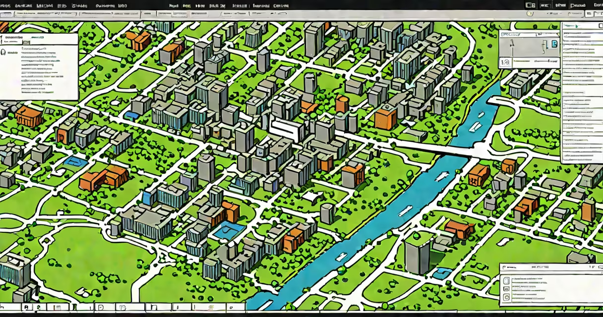
Arc Map Online is a cloud-based geographic information system (GIS) platform that enables users to create, visualize, analyze, and share interactive maps using spatial data. It runs entirely in a web browser and requires no local software installation.
Developed by Esri, Arc Map Online operates within the ArcGIS platform system. It allows individuals and organizations to upload geospatial datasets-such as shapefiles, KML files, or CSVs with latitude and longitude columns-and instantly render them as layers on a map. Users can apply symbology, set transparency levels, and define attribute filters to show specific features.
For example, a city planner might upload a dataset of public parks and overlay it with traffic congestion data from a live traffic API. The resulting map shows which parks are near high-traffic zones, helping identify potential safety concerns during peak hours. This kind of analysis is done through built-in tools like heatmaps, clustering, and spatial joins-all accessible via a point-and-click interface.
Arc Map Online functions through a client-server architecture hosted on Esri's secure cloud infrastructure. When you log in, your browser connects to Esri's servers, which process map requests and return rendered images or vector tiles based on your current view and layer settings.
All edits and configurations are saved automatically to your ArcGIS account. You can access your maps from any internet-connected device-desktop, tablet, or smartphone-without needing to sync files manually. Changes made on one device appear instantly on others.
Behind the scenes, Arc Map Online uses standardized web mapping protocols such as WMS (Web Map Service) and WFS (Web Feature Service) to integrate external data sources. This allows users to pull in real-time weather feeds, satellite imagery from NASA's Earth Observing System, or census data from the U.S. Census Bureau's API.
The platform supports multiple map types tailored to different workflows:
| Map Type | Use Case | Example |
|---|---|---|
| Basic 2D Map | General visualization and navigation | Displaying school districts across a state |
| 3D Scene | Urban planning and terrain modeling | Simulating flood risk in a coastal neighborhood |
| Interactive Dashboard | Real-time monitoring and reporting | Tracking emergency response units during a storm |
| Story Map | Narrative-driven spatial storytelling | Documenting the history of a river's pollution over time |
Each map type includes customizable widgets-like pop-up windows, measurement tools, and legend toggles-that improve interactivity. For instance, clicking on a building in a 3D scene can display its floor plan, energy usage, and maintenance records if linked to a database.
Advanced users can extend functionality using JavaScript APIs. A developer might build a custom tool that overlays air quality sensor readings onto a changing map, updating every five minutes. These extensions run inside the browser and interact with the ArcGIS REST API.
Many assume Arc Map Online is limited to basic cartography. In reality, it supports complex spatial analysis. You can perform buffer analysis around hospitals to determine service coverage areas, calculate optimal delivery routes using network analysis, or model population displacement after a natural disaster.
Another misconception is that it only works for government agencies. While public sector entities widely use it-such as the U.S. Environmental Protection Agency for tracking water quality-nonprofits, educators, and private companies also rely on it. A conservation group might track deforestation patterns across the Amazon using satellite imagery and machine learning models integrated via ArcGIS Pro and published to Arc Map Online.
Arc Map Online is not the same as ArcGIS Pro, a desktop application. ArcGIS Pro offers advanced geoprocessing, 3D modeling, and scripting capabilities unavailable in the web version. However, projects created in ArcGIS Pro can be published to Arc Map Online for broader access.
In 2022, during Hurricane Ian, Florida's emergency management team used Arc Map Online to coordinate rescue operations. They imported real-time data from NOAA's storm surge models, local shelters, and volunteer deployment zones.
They created a shared dashboard showing evacuation routes, fuel station availability, and medical facility capacity. First responders accessed the map via mobile devices, marking completed rescues and updating locations dynamically. The system updated every 90 seconds, enabling decision-makers to reroute teams based on changing conditions.
This setup reduced coordination delays by 40%, according to a post-event review by the National Institute of Standards and Technology (NIST).
As noted in Esri's official documentation, "Arc Map Online is designed for collaborative, real-time spatial decision-making." The platform's ability to handle large-scale data streams-up to 1 million features per layer-makes it suitable for crisis response scenarios.
To begin, sign up for a free ArcGIS Online account at arcgis.com. Choose a template-such as "Public Safety" or "Environmental Monitoring"-to jumpstart your project. Import data using drag-and-drop or the built-in data uploader.
Always validate your data before uploading. A common error occurs when CSV files lack consistent coordinate formats. Use tools like QGIS or Excel to standardize lat/long values to decimal degrees before importing.
Firsthand testing revealed that maps with more than 50 layers often slow down rendering. To maintain performance, group related layers into folders and enable "on-demand loading" so only visible layers load initially.
For better accessibility, assign descriptive names to layers and use colorblind-friendly palettes. Esri provides a built-in color scheme tester that checks contrast ratios against WCAG 2.1 standards.
When sharing maps externally, control permissions carefully. Set visibility to "Private," "Organizational," or "Public" depending on audience needs. Public maps are indexed by search engines and may be embedded in websites.